Slum Dwellers Engage Policy Makers on Land Tenure
By Benson Osumba and Nyasani Mbaka
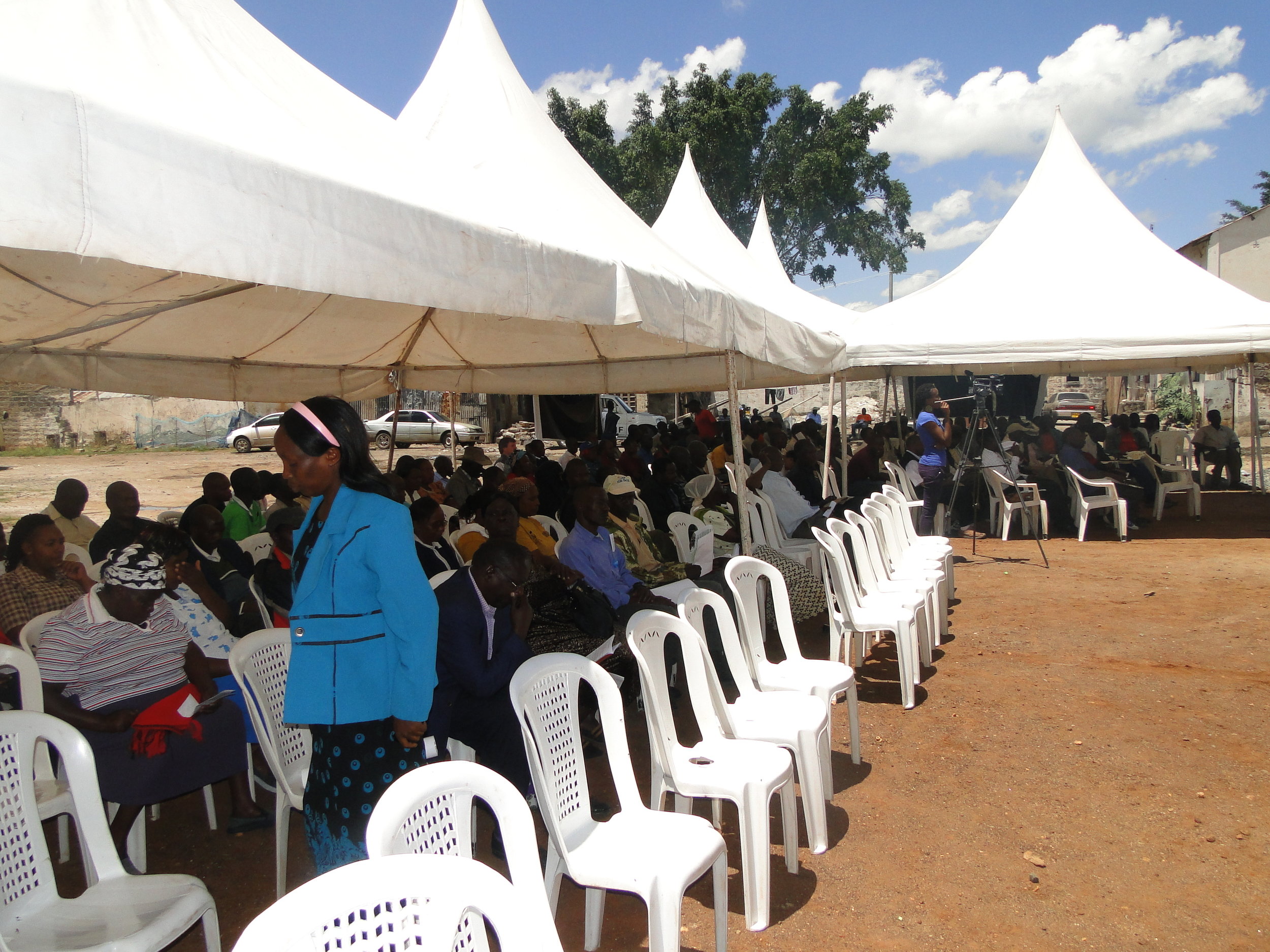
Kenya continues to seek land reforms in the land sector. Forty- four years of post independent Kenya, the issue of landlessness continues to dominate the nation’s social and political discourse. Land provision today, is an all important priority of the new constitution. As a result of land inequalities bombarding the urban poor, Muungano wa Wanavijiji (urban poor movement) was formed to address land tenure in urban poor slum settlements in the country. Perspectives that the federation has endeavored to address include; engage policy makers to advocate for land to settle the poor, act as whistle blowers of grabbed public and private lands within slum settlements, corruption and illegal land dealings, address issues of forced evictions, advocate for emergency measures on catastrophic impacts of flash floods in settlements.
DSC00627
a past urban poor Land Convention
At hand, the federation in partnership with its support organization, Muungano Support Trust is working on modalities of secure land tenure to communities living in urban informal settlements, such as Mukuru Kwa Njenga (Nairobi), Kiandutu (Thika), Timau (Meru) Nyamaroto and Kwa Ronda settlements (Nakuru) and Athi River among other areas. Over the years, the federation has opted to change strategy from the radical means of engagement to the conventionally accepted means of conflict resolution, “dialogue” with factual analyzed set of data gathered from slum settlements that the federation is undertaking sanitation & housing projects and negotiations for land tenure.
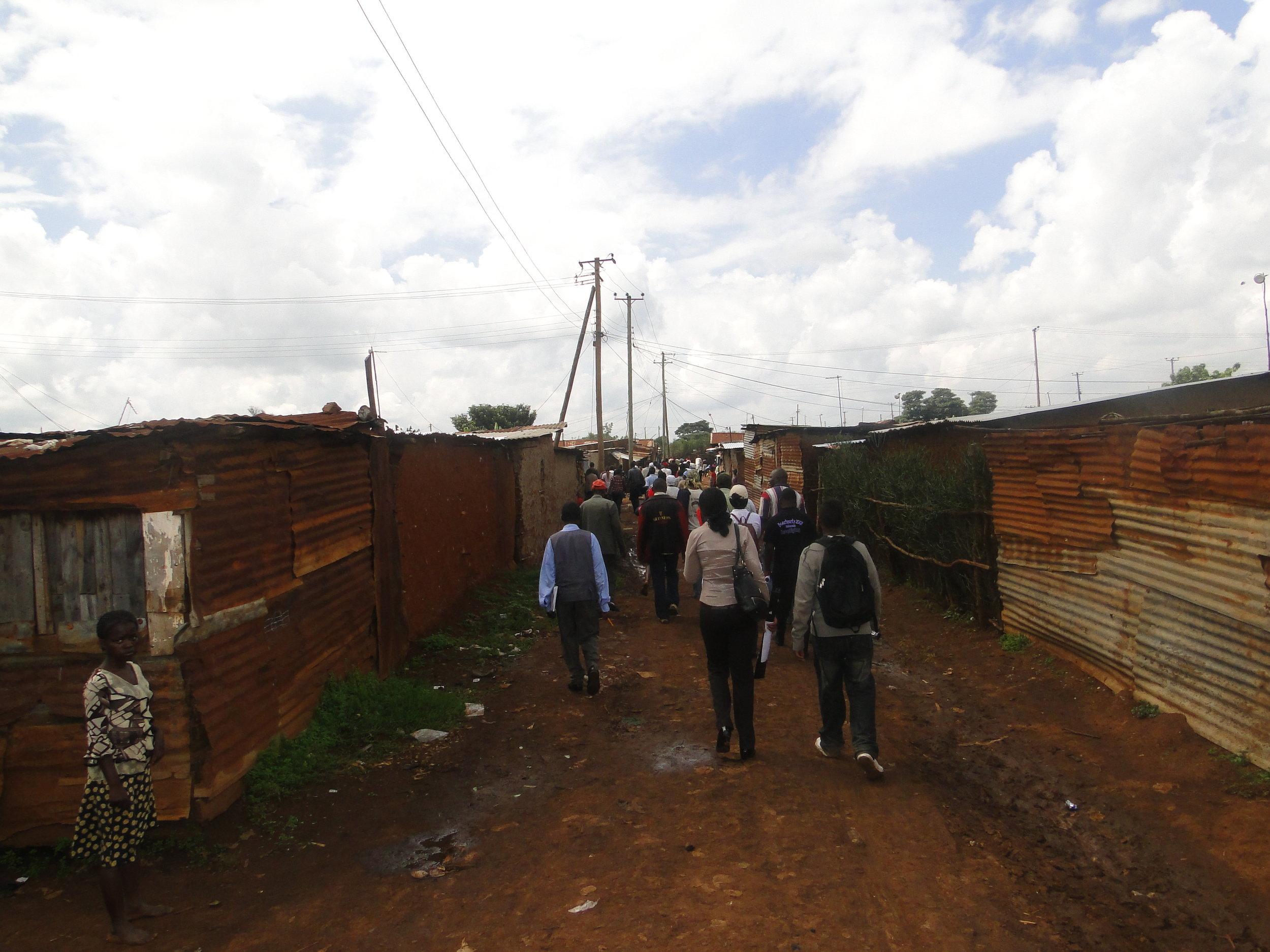
Community capacity to collect data for engagement
Data collection is a powerful tool for community engagement in planning and upgrading processes. Through settlement enumeration the urban poor federation in Kenya (Muungano wa Wanavijiji) has aided the urban poor communities organize themselves to oppose demolition and forced evictions, and to develop their own settlement plans for adequate housing and basic services.
Why Enumerations? Enumeration processes, regardless of the dynamics of the settlement, brings communities together for a common purpose and strengthens their willingness and capacity to engage in community development. Communities identify, specific needs and challenges based on their own analysis and interpretation, in a process of consensus building, data gathered is entirely owned by the communities as enumerated communities, continue to share information with local authorities, service providers and development partners.
Enumerations criteria have the following components;
Community Profiling, – Community members work closely with community leaders and local administrations to put together a settlement profile that helps to identify the key actors, the issues faced by the community and their priority needs.
Social processing – This involves sensitizing community and team building. The survey form is prepared with the community to ensure their desire to support and participate in the process.
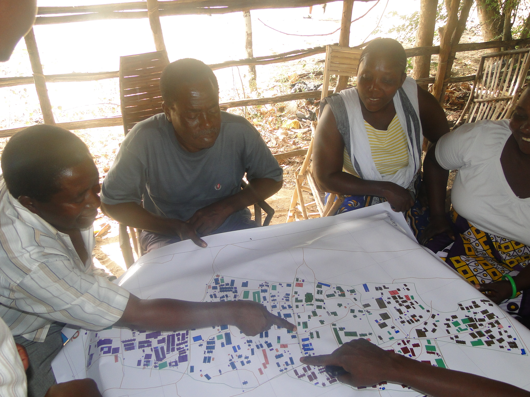
Mapping – the enumeration team would then prepare shape files of the community as it is – identifying key features including housing, public toilets, water taps, transport points, schools, clinics, etc. Developing this field map is another important mobilization tool as it can be used to deepen interest and commitment in the community.
Data Compilation – As completed enumeration forms start coming back, they are compiled manually by community members and findings are established. The findings are then posted up in the community resource centers for residents to check if they have been enumerated and that the information is accurate.

DSC09310
An enumerations process
Data Capturing – A database is created data is keyed in. The data is then analyzed, corresponding digitized mapping is prepared, along with graphs and charts presenting the data. A simple report is then drafted.
Data Verification – Individual/household reports are extracted and compiled from the database, which includes all information collected on each form. Every household is presented with their own report and the opportunity to update or amend the information created.
Community Presentations – The final data, maps, graphs/charts and report with a narrative of the analysis is presented by the community to the local authorities, along with their priorities for action.
Stakeholder and service provider engagement; to address issues identified from mapping and enumerations.
Communities’ Capacity to use data for Engagement to secure Tenure
Kiandutu Informal settlement is among the largest informal settlements in Kenya and arguably the largest informal settlement located outside Nairobi City. It lies within Thika municipal and to a regional context within the Nairobi metro region. The settlement is expansive, occupying an estimated 100 acres of land and with a population of about 13, 000 people and 5, 000 households.
DSC09039
Kiandutu settlement
To strategically drive the settlement towards upgrading, innovative community skill organization came into play with the aid of experienced Federation members, after mobilizing the community around organized savings, engagement with Thika Municipal council begun with a focus on working jointly to profile the settlement, as well as develop mutual partnership between the community and the local authority. The other key partner in this process is the University of Nairobi, Urban Planning School-Department of Urban and Regional Planning of which they played part in aiding planning strategies for the settlement.
Need For Profiling Kiandutu
Kiandutu lies on a trust land and regularization of tenure is a prerequisite for house improvement in the settlement. Notably, the settlement has a considerable low housing density, giving some households the luxury of fencing their territory, a scenario so difficult to sight in urban informal settlements.The Municipal Council is developing strategies for regularizing and formalizing informal settlements within its authority, as well as undertakes sanitation improvement projects in the settlement. The key deliverables of this project is the construction of various sanitary blocks (pit latrines) and currently an ongoing sewer line construction.

KIANDUTU TOILET BLOCKS CONSTRUCTED BY THIKA MUNICIPSL COUNCIL
One of the public toilet facilities in Kiandutu
However, the sanitary blocks are inadequate and the model typology is not sustainable, this yields to high demand for sewer infrastructure in the settlement. Water supply in the settlement is as well inadequate and haphazardly reticulated making it highly inconvenient for accessibility. Waste management is almost non-existent with garbage deposits scattered all over the settlement. There is no single paved road within the settlement, which makes mobility and circulation during the rainy season a nightmare; in regards to housing, earth and timber walled structures dominate the housing typology in the settlement. Nevertheless like many other informal settlements, the housing models are in pathetic condition.
The profiling of the settlement was conducted concurrently using three tools; enumerations, mapping and household sampling survey. With the nature of enumerations being political, the technical team ensured that the tool designed for the enumerations is simple and effective for uncomplicated data capture. This tool was shared with both the community and the municipal authorities where each party endorsed it for use in the exercise.
In an effort to capture detailed data, vital for supporting planning, the University of Nairobi spearheaded a baseline survey, which ran parallel to the enumerations with none interfering with the other. Mapping was interlinked with enumeration, with the numbering process acting as the link between the two. Enumeration forms had a unique structure code that was mapped making it possible to link and associate this data after data entry. Mapping focused on detailed mapping of structures and the existing infrastructure.
Photo of a numbering Process to aid mapping process
Post-Enumerations and Mapping
Difficult it is to attain 100 percent coverage of all households in an enumeration, and as a result, a viable target is set. The un-enumerated households are later enumerated should the need for verification exercise succeed. The viable coverage target develops a viable data base that can be authenticated through a verification process. With ground enumeration having been conducted, the next key phase of this process is data processing. Part of the major planned activities is a joint planning studio. This studio is being organized by various partners: MuST & Slum Dwellers International and the African Association of Planning Schools, to deliberate on planning aspects of the settlement.
The council is anticipating to use the data in aiding planning for the settlement. With the settlement having interest from various development outfits, this process is perceived as an avenue for initiating various development projects in the settlement.
The aftermath of enumerations and mapping is often considered a challenge of managing community expectations. Enumerations and mapping is no doubt a powerful tool for mobilizing communities. With the process having been endorsed by the key stakeholder, Municipal Council of Thika, it is probable that strategic engagements among all partners will yield to a development initiative that will positively impact on the physical and socio-economic character of the settlement.

DSC09428
Community Mapping process
Mibuyu Saba Settlement, Kilifi
Mibuyu Saba in Kilifi District was classified as Private land owned by Sir Ali Bin Ali, in 1920 residents begun settling on the 25 acres piece of land, due to its vastness and under developed nature. The land was then transferred to the Kilifi County Council and set aside for Light industries. As time progressed, communities moved to occupy the land as a residential area. The Mibuyu Saba community then began to advocate and negotiate for the 25 acre parcel of land. Unfortunately these efforts flopped time and again.
DSC00211
Mibuyu Saba scrutinizing their new settlement Map
The community through conjoined efforts with Muungano wa Wanavijiji, conducted enumeration and mapping exercises to ascertain the number of residents living in contrast with the standards of infrastructure. The data generated from this process was analyzed and compiled. The data was then used to engage the Kilifi County Council on the need to release the land to the urban poor of Mibuyu Saba. After flagships of intense negotiations, the Council through the Planning ministry department, In April 2011, released the first Part Development Plan (PDP) published under the lands gazette notice.
The community’s success to advocate for the land allocation from the council has elicited a sense of inspiration and is geared towards mobilizing resources for their housing projects. But owing to the nature of poverty in the area, the beneficiaries have begun in earnest to do savings towards the Mibuyu Saba housing project, they have also engaged Akiba Mashinani Trust (Financial Arm of Muungano wa Wanavijiji) to extend house construction loans to its members, which is expected to be repaid at an interest rate of 6 per cent per year over the next 8 years. Discussions are underway to expedite this process immediately the community secures its Land tenure. The community has also been issued with a certificate of Residency, which recognizes residents as members of the settlement, a move that was welcomed by the local administration and the community.