Focus on Kilifi (Mibuyu Saba) and Malindi (Mtangani) settlements
Settlement Background
Mibuyu Saba

Mibuyu Saba settlement is located in Kilifi District of Kilifi County. The district has a total populace of 281,552 according to 2009 population census. The district is located northeast of Mombasa. The land in Mibuyu saba, currently being negotiated for by the Kenyan federation of slum dwellers belongs to the Town Council of Kilifi and it is on this basis that the Kilifi Town Council authorized the preparation of a Part development Plan (PDP) for the area.
In 2009 the Kilifi District surveyors, surveyed the land, and picked the structures and household units on the land which assisted them develop a base map for the Mibuyu Saba land.
Submission of Community Data
In March 2012 a team from MuST visited Mibuyu Saba to return a documented series of community information and as well follow up on the land process currently going on.
Community Consultative meetings
a) Mibuyu Saba Community meeting
The first meeting was held in Kilifi, where the team met with community members to present the mapping results as well as chat the way forward on the proposed subdivisions of land. The map was presented to the Mibuyu Saba residents by Edwin Simiyu (MuST).
The community members were given an opportunity to identify if their structures were correctly mapped and also to identify if other infrastructures within the settlements were correctly mapped. From the presentation, several issues came up:
Most structures (more than 80 per cent) had been correctly mapped except a number of them that were either left out during the mapping process or the numbers were interchanged.
The road infrastructure had been correctly mapped including the existing footpaths. As a concern from the community members, the tarmac roads within the area were limited and hence the need to address the issue of motorable roads within the proposed subdivisions.
The electricity infrastructure had been mapped correctly except about one third of the power lines that had not been mapped.
The water infrastructure had been fairly mapped.
There was need for verification to facilitate filling in the gaps that had been left during the initial mapping process.
Community Savings
Muungano wa Mibuyu Saba has 179 members and most tenants are part of the savings scheme hence making it active. AMT field agents on the ground have conducted a number of trainings to help strengthen the saving schemes.
Mapping verification process
Based on the mapping results that had been presented earlier to the Mibuyu Saba community, the community agreed that the maps should be verified to capture
a) The missing structures/infrastructures
b) Correct misplaced/misspelled numbers
c) Correct other errors committed during the mapping process
A team was selected from the community where representatives from each cluster were identified, especially those who participated in the initial mapping process, since they have the expertise needed to verify the maps. Maps were then printed per cluster and each team was trained on the aspects to be verified and commissioned to work with supervision from the MuST professionals.
During the verification process, it emerged that people had really understood the effectiveness of the method in determining the final beneficiaries of the process. This was based on the initial mapping process where some of the people had started even converting the use of different structures to stand a chance to benefit more. For instance, a house designated for chicken in the initial data collection process had already been converted into residential use. This in itself suggests the need to wind up the data verification process as soon as possible, since the information is bound to change tremendously.
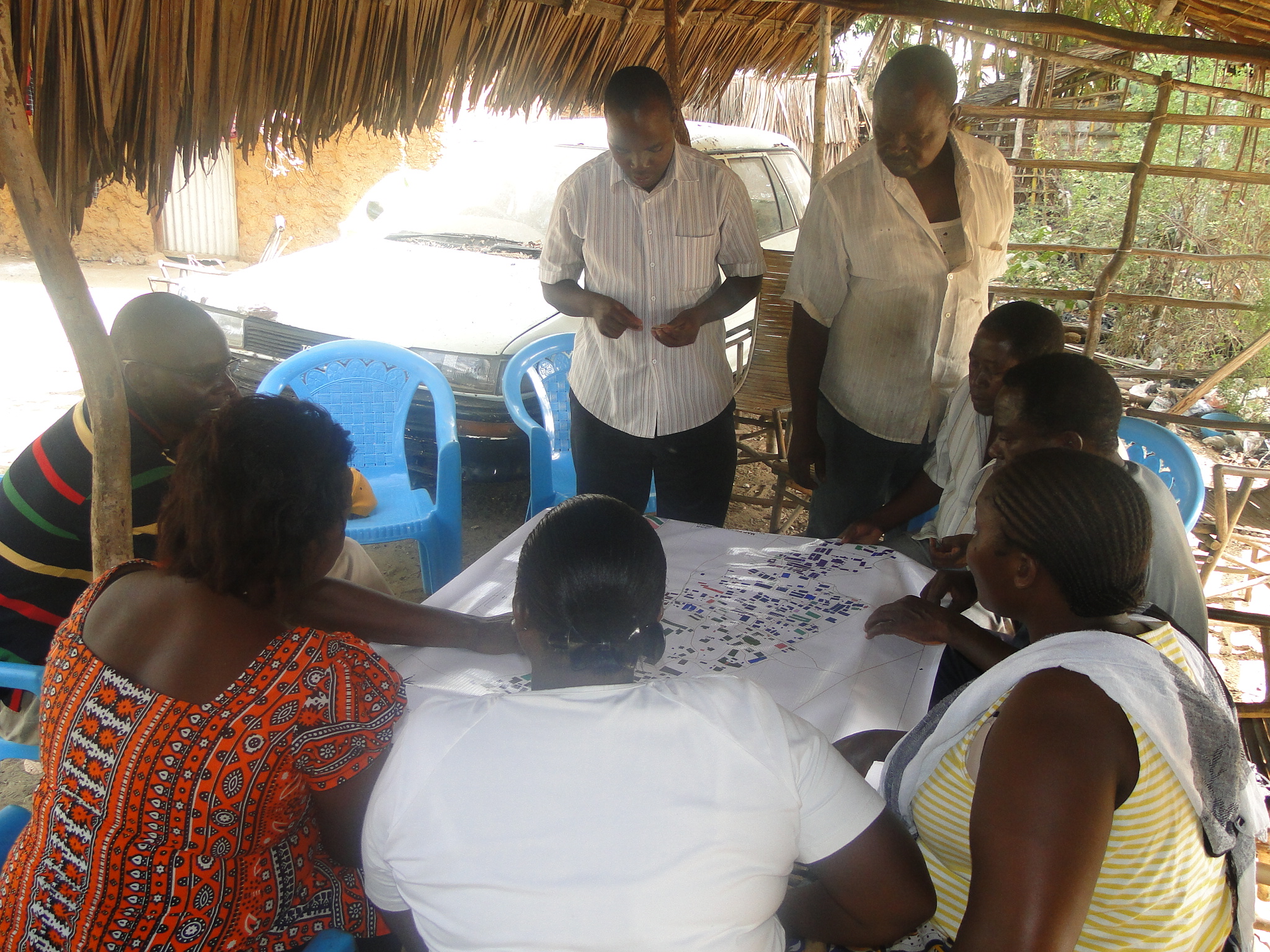
Photo 1: Mibuyu Saba residents identifying their mapped structures
The relationship between the community and the local town council planning department has been outstanding and the community believes the council is willing to allocate them the land in question. In fact discussions were already underway to facilitate those tenants who might qualify for allocation but miss out on the initial allocation process to be given an alternative land.
Mtangani Settlement Background
Mtangani
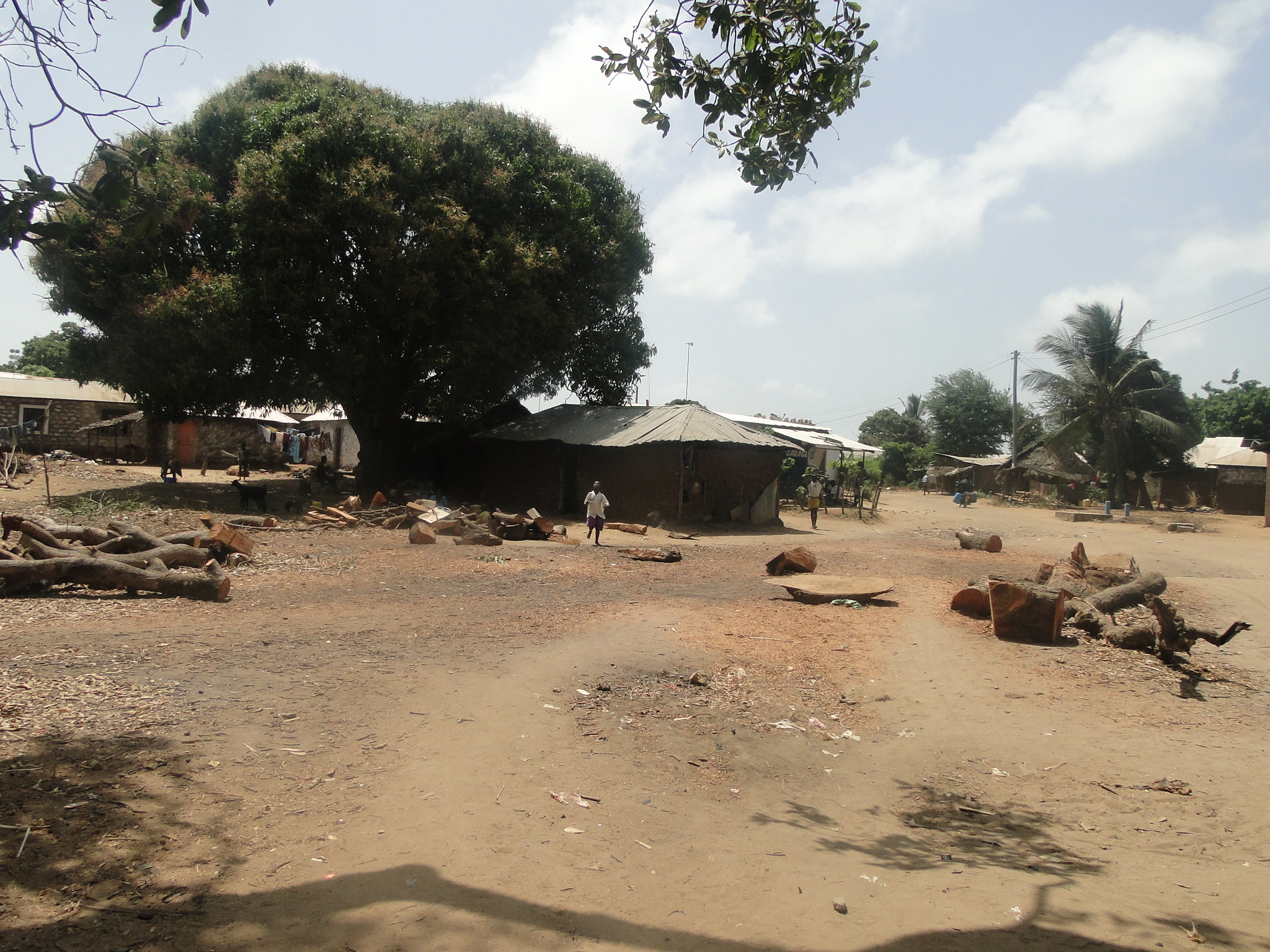
Mtangani settlement is located in Malindi District of Kilifi County. The district was founded in 1996 in a bid to bring administrative services closer to the people. It borders Kilifi District to the South, Tana River district to the North and Northwest and the Indian Ocean to the East. Its total area of 7605 square Kilometers is divided into three divisions, Malindi, Marafa and Magarini.
Malindi division is the largest (5259 Km2) and Magarini is the smallest (729 Km2). The district has two constituencies namely, Magarini and Malindi. The poverty level in Malindi District is relatively higher than that of the national poverty level 0f 56 per cent. Malindi district poverty assessment report 2000 shows that 66 per cent of the population lives in absolute poverty.
During the 4th call of the Water Services Trust Fund (WSTF) project proposals, Mtangani was designated for water project proposal and hence the community sought the intervention of Muungano wa Wanavijiji to gather essential information that could be used to push for the water proposal. This then paved way for Muungano-nization of the settlement as well as the mapping and data collection for the area.
Mtangani Community Meetings
The Community meetings were held to discuss the progress of Muungano in Mtangani as well as lay the stage for presentation of the mapping results to a wider Mtangani community.

Photo 2: Muungano wa Wanavijiji (Mtangani) member mobilizing community members
Muungano wa Mtangani, discussed extensively on the saving scheme performance and other emerging issues. Mtangani area is under an eviction threat, whereby a private developer who claims ownership over the land was ready to subdivide the land and sell it to willing buyers. The whole land under threat extends beyond the two villages of Kalima Poa and Mtangani and covers up to 130 acres.
As a strategy to bring this grouping on board, Muungano was tasked to mobilize them for the presentation of the mapping results in order provide an avenue for them understand what Muungano is all about and the advantages of working with Muungano rather than fighting them.
Scenario Building
The second meeting was a presentation and scenario building session with the rest of the Mtangani community. The leaders of the parallel group discussed above were part of the audience during this presentation session. The presentation took place at Kwa Kiraho (video center) in Mtangani village.

Photo 3: Mtangani mapping results presentation
Emerging Issues
The road infrastructure was well mapped. Most of the roads existing within the settlements were footpaths and most of them were disconnected and hence poses a great danger in times of emergency. For instance most people recognized the fact that incase of fire outbreak, it may be a challenge to get the firefighters to the affected areas. Others also noted the fact that it may be a challenge to even get an ambulance to take a patient to a hospital in case of an emergency case. This therefore elicited discussions on how to better the access routes within the area in order to facilitate safety of the residents.
The institutions existing are very limited compared to the population in the area. A total of 15 institutions were mapped (including churches, schools, health centres).
The ratio of toilet to people was far above the accepted levels. For instance in Mtangani village the average ratio of toilet to people was 1:33 and for Kalima poa village the ratio was 1:15. On average the entire area has a ratio of 1:24. Another factor in this case is that most of these toilets are not hygienic enough or are not permanent facilities.
The ratio of bathrooms was far lower than even that of toilets implying that many people either bath outside their houses or they double up the toilets as bathrooms also. This in itself poses a health risk. For instance the entire area has a ration of bathrooms to people of 1:45.
The need to do a map verification process to map households that had not been mapped during initial mapping process and also to capture some of the infrastructures that might have been left out in the initial process so as give accurate information of the area. There was also need to do an enumeration of the area to help generate data that can be used even to fight the ongoing land cases and overall land tenure objectives.
The community therefore agreed to consolidate themselves around the five clusters (Mtangani A, Mtangani B, Mtangani C, Kalima Poa A and Kalima Poa B) in order to use this information and draft proposals on the best was to assist their respective areas.
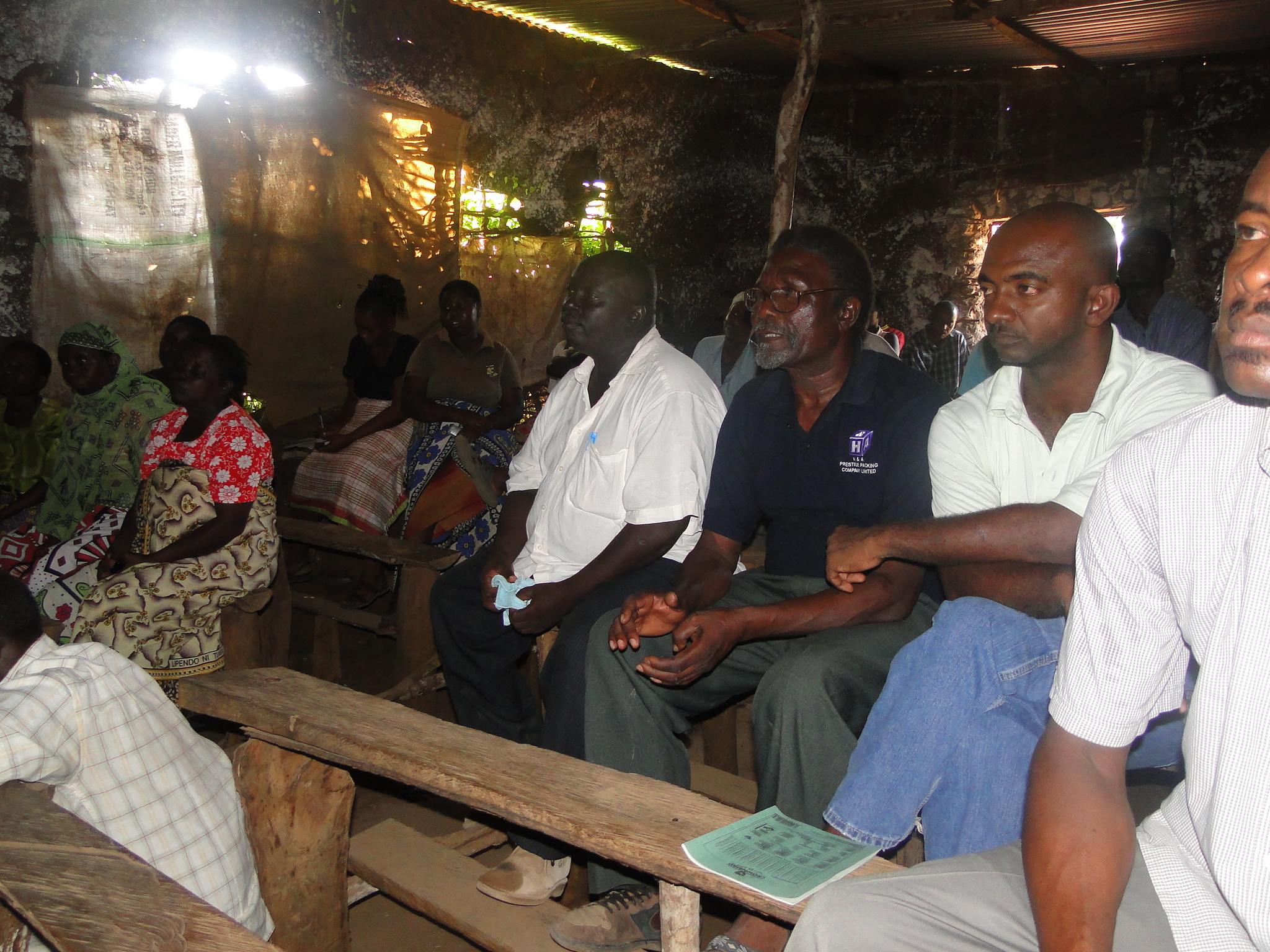
Photo 4: Mtangani community mapping results presentation forum
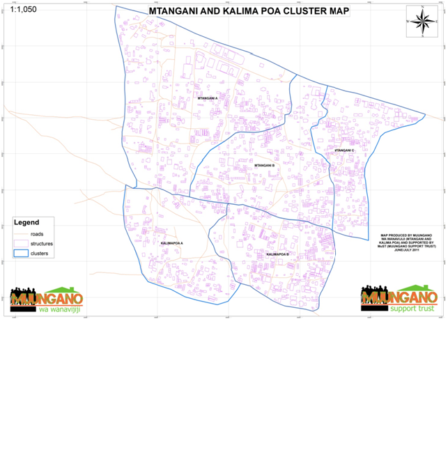
Mtangani and Kalima Poa
Figure 5: Mtangani cluster map
Stakeholders meetings
a) Meeting with Kilifi District Physical Planning department
The meeting took place at the planning offices in Kilifi town. In attendance were Muungano wa Wanavijiji, MuST and Kilifi Planning officials. The mapping results were shared with the planners and they appreciated the importance of the map in the context of subdivision scheme planning.
Based on the map for instance, they can use it as a base map in refining the part development plan (PDP) that had been earlier developed. The planning department also expressed interest in doing a similar data collection process in another settlement of Kilifi which the department is discussing.
b) Meeting with Malindi Water and Sewerage Company
The meeting took place at MALWASCO offices in Malindi town, next to the Malindi Municipal Council. The team from MuST met Mr. Kai Cosmas (officer in charge of the G.I.S/Technical section) and Mr. Tsuma (the officer in charge of the social component-sociologist). The discussions revolved around a number of things including: the mapping results, the progress of the Mtangani water project, 5th call proposals and interface between the water company and the community.
We shared the mapping results for Mtangani. From the maps, the MALWASCO officials could be able to easily identify where the pipes will be more appropriate to place them as compared to their previous designs. One of the pipes they had proposed was lying on airport runway and hence they could be able to identify the options of relocating it. There proposal coincided with the community proposal, which had earlier proposed that line be put on a road running parallel to what the water company had initially proposed to be the main trunk line. This therefore strengthened the fact that there was more gain when the water company works with the community.
The map also helped in advising them on the densities of the different portions of the settlement and hence useful information especially in designing for the water kiosks and yard taps
Water Project Progress
The water Company shared with Muungano wa Mtangani and MuST on the Mtangani water project progress. The water project was covering at least two sub-locations (Mtangani central and Furunzi). Mtangani central covers the areas of Mtangani and Kalima Poa where the federation did the mapping process.
The water company is meant to provide a 2 inch main pipe and water kiosks as well as yard taps within the project area. From the discussions it was agreed that the community members are at liberty to organize themselves into groups and request for household connections and the water company will be able to assess these proposals and implement them where possible.
The water project had been initiated and the digging of trenches had started at Furunzi as it moves towards Mtangani. A total of three water kiosks had been designated for Mtangani in addition to the already existing water kiosk. This was meant to bring access to water closer to the people as compared to one water kiosk which was only located in Mtangani C cluster. Most of the people within the settlement had to travel long distances to access this water point. Four yard taps had also been designated to boost the water kiosks in supplying water to these villages of Mtangani central.
The water company had already finished a proposal for fifth call and forwarded to the Water Services Trust Fund. The areas covered during the fifth call were Maweni and Kibokoni. It was the hope of the water company to work with Muungano in these new areas if the proposal is approved by the W.S.T.F putting in mind the challenges that comes especially on the social aspect of the project.